| ||||||||||||||||||||||||||||||||||||||||||||||||||||||||||||||||||||||||||||||||||||||||||||||||||||||||||||||||||||||||||||||||||||||||||||||||||||||
A Brief introduction to Pakistan
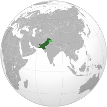
PAKISTAN: A Brief Introduction Pakistan is a country situated in southern part of Asia, in its north lies China the Central Asian states and the Russian federation, to the west is Afghanistan and Iran while to the east is India. Pakistan has four provinces namely Punjab, Balochistan, NWFP and Sind. Islamabad is the capital of Pakistan, and five districts of the northern areas are administered directly from the Capital. Officially these districts are called Federally Administered Northern Areas (FANA). Pakistan came into being as the result of the partition of British India in 1947. Pakistan is one of the diversified countries of the world in terms of its culture, landscape, and climate. To the north of Pakistan is the highest mountain system of world, having its harsh climate. To the west are the fertile plains of Indus valley. While to the western and southern part exist the steaming deserts. Within its borders situate the Arabian Sea, best root of Asia; this sea moderates the climate of its southern parts. The area of Pakistan is 796096km2 while its population is around 140 million. Pakistan is an agricultural country. Its major exports include the agricultural products like cotton, sugar, rice and textile. The literacy rate of the country is nearly 40%. Urdu is the official language of Pakistan where as English is used for education, trade and other purposes. Pakistan's cultural heritage is very rich it has inherited the rich cultures of the thousand of years old Indus and Ghandara civilizations.
Northern Areas of Pakistan:
The northern areas officially named as Federally Administrated Northern Areas (FANA) are situated to the extreme north of Pakistan. To its north lies China while to the northwest Wakhan and the central Asian states exist, to the eastern sides are parts of Ladakh and Indian held Kashmir while to the south are the Areas of Pakistani held Kashmir. On the west side the district Chitral is situated. Northern areas are comprised of five districts named as Gilgit, Ghizer, Skurdu and Ghanche. Population of the region is about 1.5 million people. The entire population is Muslim and they believe in different interpretations of the faith. People of the region live in rural communities and their source of livelihood is subsistence agriculture. However after the construction of roads this area has been opened for the outer world and people have migrated to the urban areas of Pakistan. Due to its natural beauty and rich cultural heritage this part of the world attracts thousands of mountaineers, trekkers and general tourists from around the world. Importance: The northern areas are located at a very key position in Asia. This is the only place where the three major parts of Asia i.e. southern Asia, central Asia and south East Asia converge. Therefore this area is known as axis of Asia. Another main feature of this region is that is it is the point of convergence of the four higher mountain ranges of the world named as the Karakoram, the Himalayas, the Hindukush and the Pamirs. Therefore it is also entitled the roof of the world. It hosts 36 of the top 100 highest peaks of the world including the K-2 the second highest mountain of the world. Besides its physical importance this region has got an immense strategic importance as well. | ||||||||||||||||||||||||||||||||||||||||||||||||||||||||||||||||||||||||||||||||||||||||||||||||||||||||||||||||||||||||||||||||||||||||||||||||||||||
| ||||||||||||||||||||||||||||||||||||||||||||||||||||||||||||||||||||||||||||||||||||||||||||||||||||||||||||||||||||||||||||||||||||||||||||||||||||||
Wednesday, 4 December 2013
Pakistan at a glance!


Subscribe to:
Posts (Atom)